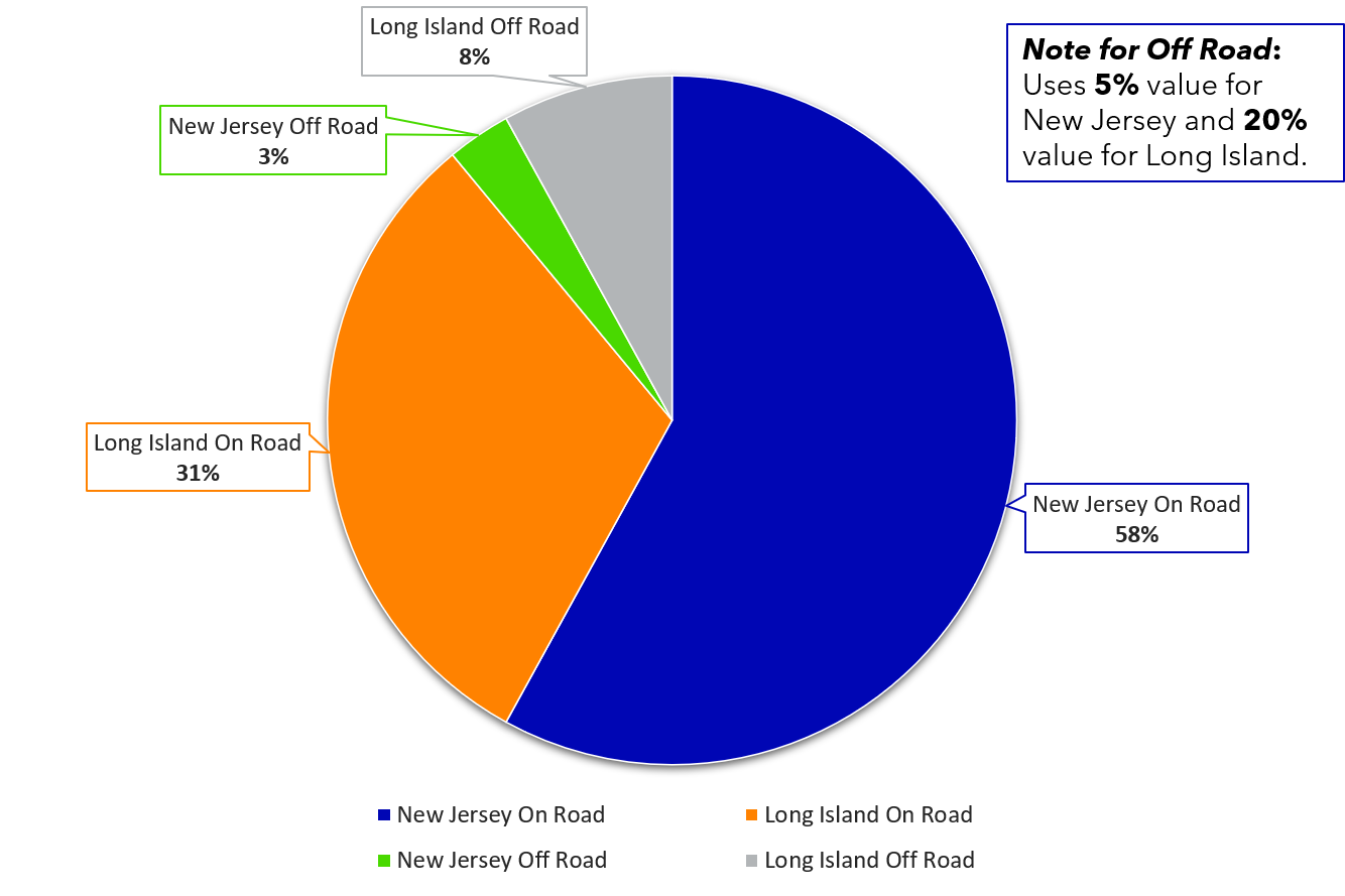
For the portion of non-road accessible circuits, Cyclomedia relies on partner capture solutions to fill that gap. By using partners, we leverage organizations that have a singular focus on their particular area of expertise. Based on our assumptions we estimate this to be 11% of the AOI.
Cyclomedia partner solutions are used as best in class supplemental tool, based on the area, type of off road gap and workflow or work process requirement.
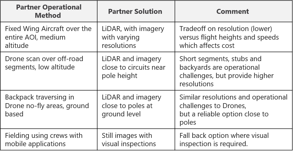
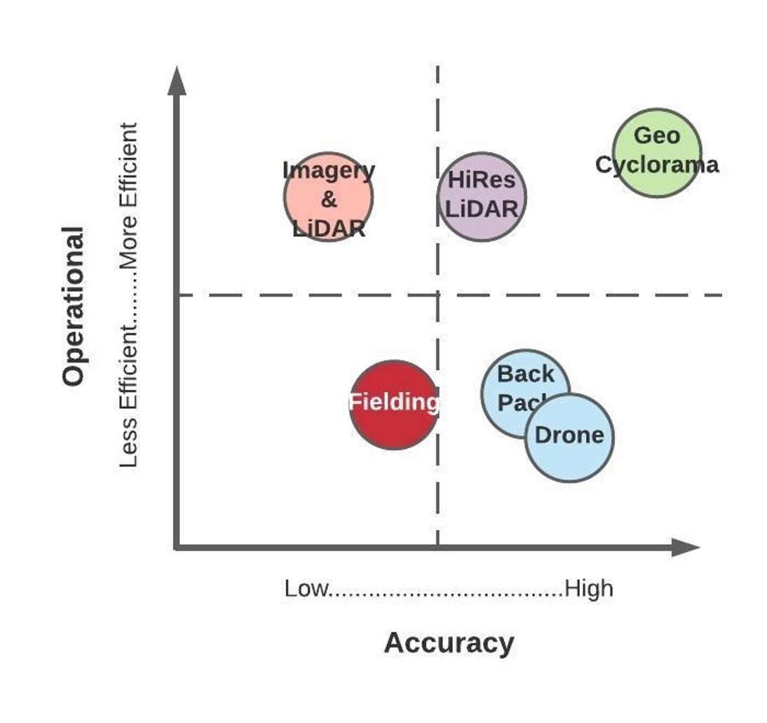
To visualize the trade-offs of our partner solutions we have mapped these on a quadrant with the X axis represented as accuracy and the Y axis represented as operational efficiency. As a rule the more efficient the lower the cost, the less efficient the higher the cost.
The Cyclomedia On-Road solution gets the top right quadrant, (Green Circle) providing the highest operational efficiency by traveling public roads at posted speeds. And the highest accuracy for both imagery (100 megapixel) and LiDAR (up to 250 points per sq meter). The supplemental partner solutions are measured and plotted in the other quadrants. Traditional fielding is also an option, where the technology solutions are unworkable or too difficult to execute. The great news about this visualization is we are only trying to solve for 11% of the solution with partners!
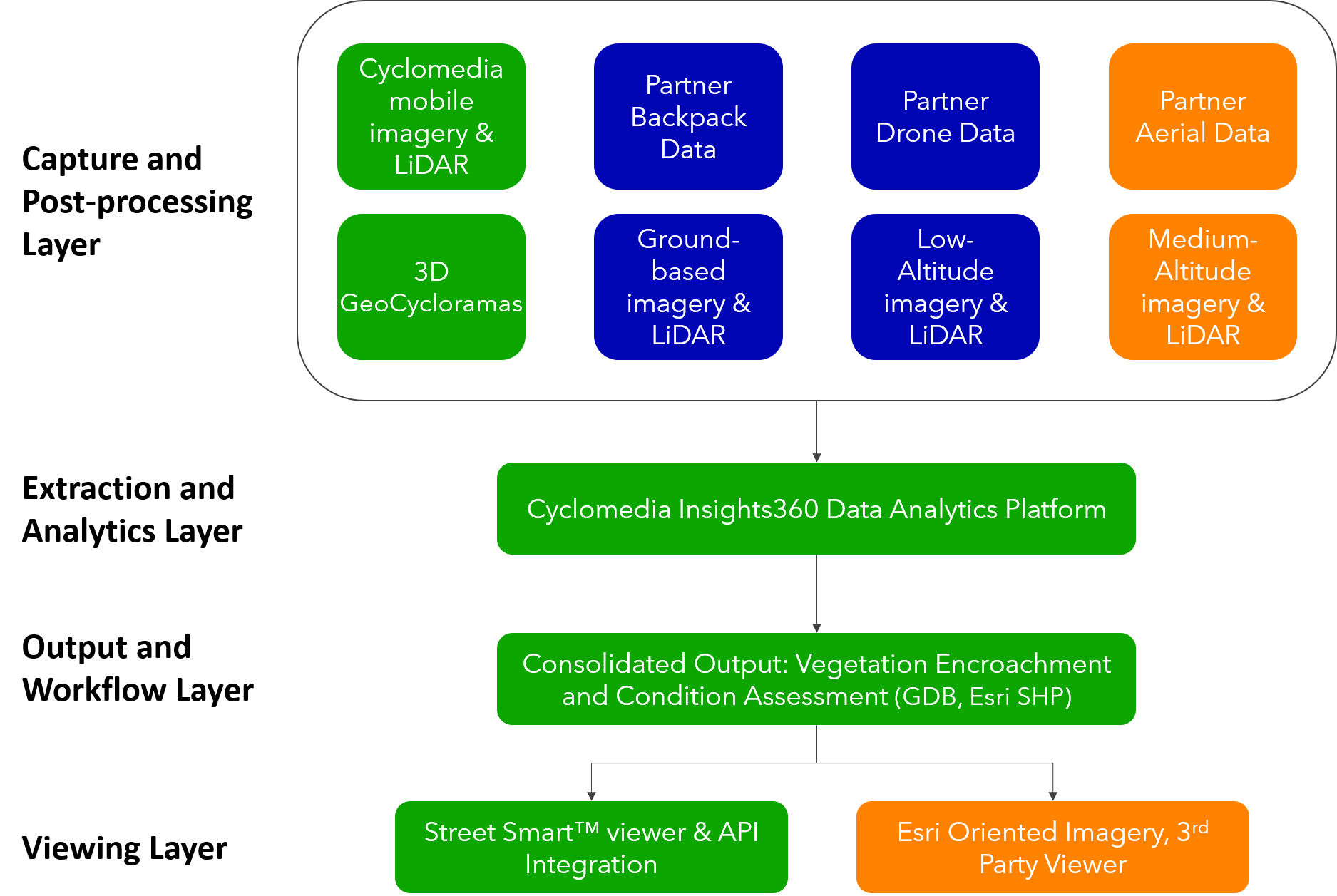
Cyclomedia Partner solutions directly align to mobile capture and analytics workflows. We convert third party capture imagery and LiDAR into out extraction format that directly imports into the Insights360 analytics platform used for our standard GeoCycloramas. By doing this, we provide a consistent output, quality, controlled to meet the customer requirement, but allowing for different scanning technologies to complete circuits and areas of interest.
The green flow boxes represent Cyclomedia technology and solutions. Partner solutions flow directly to the work output result, with the Street Smart viewer used to visualize 89% of the captured imagery over 22,800 miles of circuits. Third party imagery may be viewed using Esri platform tools or other standard third party viewers that may be linked into the workflows.