“It’s worth every dime, nickel, quarter, and dollar. We are so proud that we’re making significant progress in reducing and eliminating blighted properties in our county.”
Contract Complete: 2013- Present
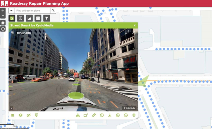
Cyclomedia has conducted seven annual collections of street-level imagery and LiDAR data across the District’s network. With a dense network of roadway assets, an important criteria for DDOT’s vendor selection was the ability to rapidly deliver a quality asset inventory. Cyclomedia extracted numerous point and linear asset types, including over 300,000 signs. DDOT’s internal testing and analysis of asset datasets estimated Cyclomedia’s extracted dataset accuracy at 99%—a testament to the fidelity and quality of our asset extraction environment. Extracted asset data was synchronized to the District’s Esri Roads & Highways LRS, delivered via an Esri Geodatabase file, and imported into numerous DDOT applications, including their City Works™ asset management system.
To further extend the value of street-level imagery and LiDAR across the organization, DDOT used Cyclomedia’s Web AppBuilder (WAB) Widget to integrate imagery tools with their web apps. Today, there are over 20 departments within Washington D.C. using Cyclomedia’s imagery and LiDAR data, including the following:
“DDOT is using GeoCycloramas to revolutionize the way inspections for repairs, construction, and permitting data are conducted in Washington D.C.”